Understanding our planet has become easier than ever through modern geographic visualization tools. From satellite imagery and interactive maps to weather systems and environmental data, these platforms help people explore the world in new and more immersive ways.
Today, many of these experiences are available directly through a web browser, making geographic exploration more accessible for students, researchers, businesses, and everyday users alike.
At the same time, people are becoming more intentional about the technology they use every day. Some platforms focus on helping users better understand the planet through mapping and environmental data, while others support sustainability in different ways.
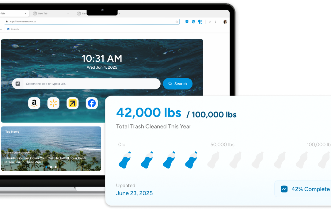
Wave Browser, for example, supports verified ocean cleanup efforts through its partnership with 4ocean, reflecting a broader shift toward technology experiences connected to real-world impact.
In this article, we’ll explore what Earth browsers are, how they work, and the different ways geographic visualization tools are used across industries and everyday life.
What Is an Earth Browser?
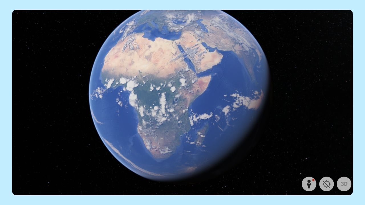
An Earth browser is a platform that allows users to explore geographic information through interactive maps, satellite imagery, and layered environmental data.
These tools help users visualize different parts of the world while interacting with real-world geographic systems directly from their browser or desktop device.
Earth browsers are commonly used for:
- Viewing satellite imagery
- Exploring terrain and landscapes
- Monitoring weather systems
- Analyzing environmental changes
- Studying geographic and climate data
- Navigating interactive 3D globes
Many modern Earth browsers are designed to be simple and accessible, allowing users to explore locations and data without requiring advanced technical knowledge.
Common Features of Earth Browsers
While platforms vary in purpose and design, many Earth browsers share several core features.
Satellite Imagery
High-resolution satellite imagery allows users to explore cities, coastlines, mountains, forests, and remote regions across the globe.
Interactive Mapping
Users can zoom, rotate, and navigate through different locations while viewing layered geographic information in real time.
Environmental and Weather Data
Some Earth browsers provide live environmental visualization, including wind patterns, storms, ocean currents, and climate systems.
Geographic Layers
Many tools allow users to overlay additional data such as terrain, transportation systems, population density, or environmental changes.
Web Accessibility
Modern Earth browsers are increasingly web-based, making geographic exploration available without needing specialized software installations.
Real-World Applications
Earth browsers are used across a wide range of industries and educational environments.
Education and Research
Students and researchers use geographic visualization tools to study ecosystems, climate trends, geology, urban growth, and environmental changes. Interactive maps and satellite imagery help make complex topics easier to understand.
Urban Planning
City planners use geographic data to analyze land use, transportation systems, and infrastructure development. These tools support more informed planning decisions and long-term development strategies.
Real Estate and Architecture
Interactive mapping and satellite imagery help professionals evaluate neighborhoods, surrounding infrastructure, and geographic conditions before development or investment decisions are made.
Environmental Monitoring
Scientists and environmental organizations use Earth browsers to monitor environmental changes, weather systems, coastlines, and natural events over time.
The Evolution of Online Exploration
As web technology continues to evolve, digital experiences are becoming more interactive, visual, and connected to real-world systems. Geographic visualization tools are part of this shift, helping people better understand how environments, cities, and ecosystems are connected on a global scale.
At the same time, broader conversations around sustainability and intentional technology use are influencing how people think about the digital tools they rely on every day.
Wave Browser reflects part of this trend by combining everyday browsing with support for verified ocean cleanup initiatives through its partnership with 4ocean.
This growing intersection between technology and environmental awareness highlights how digital platforms are increasingly expanding beyond basic functionality alone.